Hyderabad, India
This year EOMAP has topped the category “Bathymetry” at the Geospatial World Innovation Awards 2017. The ceremony took place in Hyderabad, India. Together with their partners SevenCs and ChartWorld, EOMAP received the award for the derivation of electronical nautical charts (ENCs) from optical satellite data and their easy pratical implementation.
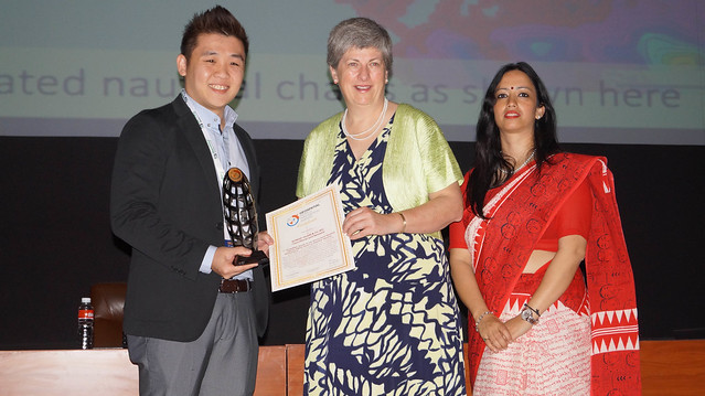
Alvin Lin from SevenCs gratefully accepted the award at the Geospatial World Forum 2017 Hyderabad. The full list of awarded companies and institutions is accessible here.
Read more on the Geospatial World Forum: https://geospatialworldforum.org/

Latest EOMAP News

Reuters bases Mekong article on EOMAP data

Cyanobacteria on the rise – algal blooms in bathing waters

SDB Update #7 – Topobathy of the Red Sea

SDB Update #6 – Satellite-based Topobathy Models

SDB Update #5 – Storymap on Satellite-Derived Bathymetry

SDB Update #4 – Northern Canada’s shallow waters mapped in 100 m
Related Posts

08 / 2025
SDB Update #7 – Topobathy of the Red Sea

07 / 2025
SDB Update #6 – Satellite-based Topobathy Models

07 / 2025
SDB Update #5 – Storymap on Satellite-Derived Bathymetry

06 / 2025
SDB Update #4 – Northern Canada’s shallow waters mapped in 100 m

06 / 2025
SDB Update #3 – The Maldives’ shallow waters mapped in 100 m

05 / 2025
SDB update #2 – The Bahamas mapped in 10 m

05 / 2025
SDB update #1 on Australia: All shallow waters mapped

03 / 2025
German Innovation Prize 2025 – EOMAP listed among top 3

03 / 2025
Deutscher Innovationspreis 2025 – EOMAP unter den top 3
01 / 2025
