EOMAP part of a new project to better understand and predict the interdependencies during major emergencies
- German Aerospace Center has joined with project partners to develop a mulit-riks information system for the Andean region in Chile, Ecador and Peru
- Kickoff of RIESGOS international cooperation project at the DLR German Remote Sensing Data Center in Oberpfaffenhofen, Germany
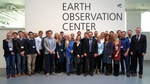
The RIESGOS project (Spanish for “risks”), an international consortium of academic research instituts and industry partners, aims to improve the information base for natural distater management to develop strategies to avoid or mitigate risks.
Web-based application services will enable decision makers and stakeholders to prepare risk analyses for the obverall situation and simulate scenarios with complex risk chains.
To learn more about the project, please refer to the German Aerospace Center press release.

Latest EOMAP News

Reuters bases Mekong article on EOMAP data

Cyanobacteria on the rise – algal blooms in bathing waters

SDB Update #7 – Topobathy of the Red Sea

SDB Update #6 – Satellite-based Topobathy Models

SDB Update #5 – Storymap on Satellite-Derived Bathymetry

SDB Update #4 – Northern Canada’s shallow waters mapped in 100 m
Related Posts

08 / 2025
SDB Update #7 – Topobathy of the Red Sea

07 / 2025
SDB Update #6 – Satellite-based Topobathy Models

07 / 2025
SDB Update #5 – Storymap on Satellite-Derived Bathymetry

06 / 2025
SDB Update #4 – Northern Canada’s shallow waters mapped in 100 m

06 / 2025
SDB Update #3 – The Maldives’ shallow waters mapped in 100 m

05 / 2025
SDB update #2 – The Bahamas mapped in 10 m

05 / 2025
Planet contract: Supporting Germany’s water monitoring

05 / 2025
SDB update #1 on Australia: All shallow waters mapped

03 / 2025
German Innovation Prize 2025 – EOMAP listed among top 3

03 / 2025
