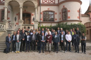
Speakers and participants of the Water Days – including SDB Day 2022 – in Herrsching on Ammersee
The presentations and recordings of the Water Days are online now.
Good news, in case you did not make it to the Water Days including SDB Day 2022: The presentations and recordings are available here. Enjoy the insights of experts on satellite-derived bathymetry (SDB) and inland water monitoring.
The feedback on the hybrid conference – split into both a coastal and an inland waters track – as well as on the subsequent workshops was very positive. 40 experts joined us in 18 presentations and discussions, socialized at the Get together during a boat trip on Lake Ammersee and the enjoyed dinner at the Bavarian Lakeside.
140 stakeholders from all over the world joined us remotely.
We cordially thank all participants for their valuable contributions. A particular “Thank you” goes to Planet and fugro for their generous dinner and lunch sponsorings.
Please follow us on Linked in or subscribe to our Newsletter to learn about future events.

Latest EOMAP News

Reuters bases Mekong article on EOMAP data

Cyanobacteria on the rise – algal blooms in bathing waters

SDB Update #7 – Topobathy of the Red Sea

SDB Update #6 – Satellite-based Topobathy Models

SDB Update #5 – Storymap on Satellite-Derived Bathymetry

SDB Update #4 – Northern Canada’s shallow waters mapped in 100 m
Related Posts

08 / 2025
Cyanobacteria on the rise – algal blooms in bathing waters

08 / 2025
SDB Update #7 – Topobathy of the Red Sea

07 / 2025
SDB Update #6 – Satellite-based Topobathy Models

07 / 2025
SDB Update #5 – Storymap on Satellite-Derived Bathymetry

06 / 2025
SDB Update #4 – Northern Canada’s shallow waters mapped in 100 m

06 / 2025
SDB Update #3 – The Maldives’ shallow waters mapped in 100 m

05 / 2025
SDB update #2 – The Bahamas mapped in 10 m

05 / 2025
Planet contract: Supporting Germany’s water monitoring

05 / 2025
SDB update #1 on Australia: All shallow waters mapped

03 / 2025
