Explore the digital twin of a unique reef ecosystem
In cooperation with EOMAP, CONABIO has created the virtual ecosystem of the National Reef Park in Puerto Morelos, Mexico.
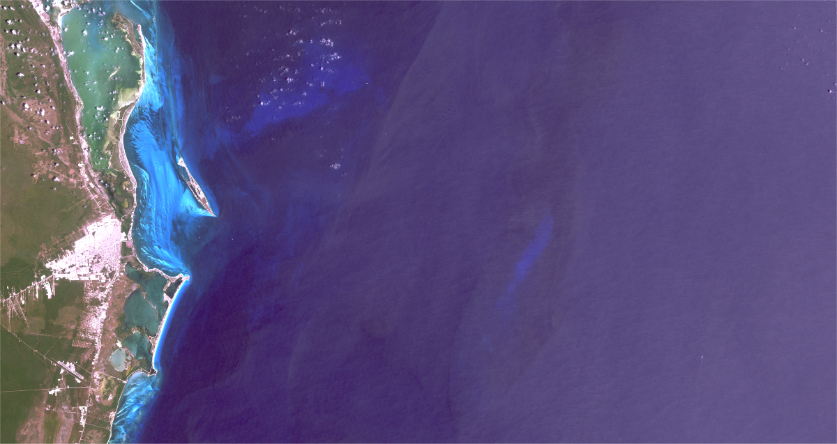
Let us experience one of the World’s largest fringing reefs, the Mesoamerican Barrier Reef in the Caribbean waters of Mexico! The new virtual reality ecosystem allows to discover the Mesoamerican Reef, also known as the “Great Maya Reef”. This largest transboundary reef system is a hotspot for biodiversity, home to marine turtles, over 60 types of corals and more than 500 fish species.
CONABIO, the Mexican National Commission for the Knowledge and Use of Biodiversity, has created a digital twin of this unique marine living space using EOMAP data. The visualized reef area covers 2.5 square kilometres.
The short video below walks us through the set-up, development and features of this innovative and interactive VR experience.
High-quality data on bathymetry and seafloor allow a near-natural virtual experience.
For this visionary VR project, the Mexican environmental authority has built upon EOMAP’s Satellite-Derived Bathymetry, seafloor classification and extensive benthic mapping data. Moreover, CONABIO’s biodiversity database comprises 20 million entries of species from the last 35 years, such as macroalgae, seagrass, fish and mammals. These served as a basis for 3D-modelling and an interactive “species library”. The VR adventure allows everyone to explore this fascinating marine ecosystem from their home. Personal experience of such a unique natural heritage can raise awareness for its protection.
In contrast to most other common 3D-geovisualisation projects, this VR experience stands out by the high-quality data used: It builds on true Geography and high-resolution bathymetry data from the Mexican region around Puerto Morelos.
The VR aplication for the desktop and immersive experience (Oculus) can be downloaded at CONABIO’s website.
In combination with VR goggles, it enables an interactive near-natural experience.
Latest EOMAP News

Reuters bases Mekong article on EOMAP data

Cyanobacteria on the rise – algal blooms in bathing waters

SDB Update #7 – Topobathy of the Red Sea

SDB Update #6 – Satellite-based Topobathy Models

SDB Update #5 – Storymap on Satellite-Derived Bathymetry

SDB Update #4 – Northern Canada’s shallow waters mapped in 100 m
Related Posts

08 / 2025
Cyanobacteria on the rise – algal blooms in bathing waters

08 / 2025
SDB Update #7 – Topobathy of the Red Sea

07 / 2025
SDB Update #6 – Satellite-based Topobathy Models

07 / 2025
SDB Update #5 – Storymap on Satellite-Derived Bathymetry

06 / 2025
SDB Update #4 – Northern Canada’s shallow waters mapped in 100 m

06 / 2025
SDB Update #3 – The Maldives’ shallow waters mapped in 100 m

05 / 2025
SDB update #2 – The Bahamas mapped in 10 m

05 / 2025
Planet contract: Supporting Germany’s water monitoring

05 / 2025
SDB update #1 on Australia: All shallow waters mapped

12 / 2024
