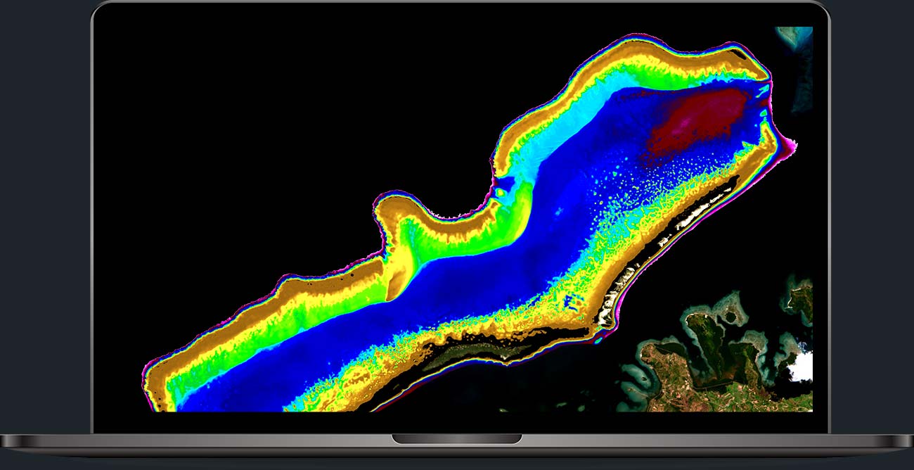
Satellite-Derived Bathymetry (SDB)

EO Mapping Services

Introduction

Satellite-Derived Bathymetry (SDB) is the most recently developed method of surveying shallow waters. In contrast to other survey methods, it requires no mobilisation of persons or equipment, provides rapid access to bathymetric data and saves costs. Satellite-Derived Bathymetry makes operations in shallow water more effective and reduces project risks.

We have developed SDB algorithms since the 1990s and strictly follow physics-based, quantitative solutions to convert the information collected by the satellite sensor into bathymetric data. As the only SDB provider, our data fulfil the highest quality requirements and are being used in recent nautical charts, operational hydrodynamic models and coastal zone management plans.

We offer SDB data in very high (2 m), high (10 m) and moderate (15-30 m) spatial resolutions. Our turnaround times range from hours (using EOMAP’s bathymetric archives) to a few weeks, depending on project location and size.

Advantages at a glance

  • Reduce mobilization of staff and equipment.
  • Significantly save costs.
  • Access high resolution bathymetric data already at an early project stage, quickly and easily.
  • Reduce risks for on-site activities.
  • Survey inaccessible and remote areas.

Request a Demo

Full 2m and 10m resolution Satellite-Derived Bathymetry datasets for demonstration can be accessed using the form below. Please fill in your name and e-mail address and submit your request. A download link will be provided by e-mail.

    Please also use our inquiry form to enquire further information about our products and how to purchase them.

    FAQ

    How can I request information for a specific site?
    Simply send your area of interest in digital format to our shallow water team, use our contact form or visit our EO Store Bathymetry. You’ll receive appropriate feedback within 24hours.

    What makes EOMAP’s service unique? Why does EOMAP’s data service stand out?
    EOMAP’s satellite-derived bathymetry services have been widely used and validated in practice. Our clients acknowledge and benefit from the quality of our bathymetric data, our extensive background knowledge and high level of service readiness. EOMAP’s SDB methods have been developed over the last two decades and are being constantly maintained and improved. No other method and service has this kind of continuous and systematic scientific validation.

    What’s the vertical datum of EOMAP’s Satellite-Derived Bathymetry data?
    All data use Lowest Astronomical Tide as the default vertical datum. Other vertical datums such as Mean Sea Level can be provided on request.

    Can I receive Satellite-Derived Bathymetry data in ENC format?
    Yes. Data can be provided in S-57 format.

    What is the maximum mapping depth and how can I query it for my location?
    The maximum water depth mapped by SDB is similar to the maximum penetration depth of sunlight. Since this varies by season and location, a global depth statement is not appropriate. The following mapping depths have been analysed: Red Sea (20–30 m), Gulf region (5–15 m from north to south), Mediterranean Sea (20–30 m), Baltic Sea (2–15 m from north to south), Caribbean Sea (20–30 m), US West Coast (5–15 m), Pacific region (20–30 m).
    EOMAP’s EO Store Bathymetry offers a unique map layer to estimate the Satellite-Derived Bathymetry feasibility and helps to explore the coverage for almost any marine location on earth.

    What are the vertical/depth uncertainties?
    Depth uncertainties are provided with each data delivery and are expressed as LE90 confidence limits, meaning that 90% of the data fall within the stated depth uncertainty. These uncertainties are a combination of internal model uncertainties (such as the sensitivity of the sensor) and external uncertainties (uncertainties regarding tides) and are compared against on-site or charting data, if accessible. With ideal scenarios and on-site information, EOMAP’s SDB data are accurate to 0.5 m LE90. Without access to on-site information, the uncertainty is typically between 0.5 m and 1.0 m LE90 and a depth dependent factor between 10 and 15% of water depth.

    What are the horizontal/geolocation uncertainties?
    The geolocation uncertainties are determined by the spatial resolution of the bathymetric data grid and thus by the satellite source. They are expressed as CE90 confidence limits, meaning that 90% of the data fall within the stated horizontal uncertainty. For 2 m bathymetric grids, the horizontal uncertainty is 5 m CE90, for 10 m grids it is 10 m CE90 or better and for 30 m grids it is 30 m CE90.

    What are the delivery formats?
    The default file types for our bathymetric data are ASCII XYZQ files (point clouds), GeoTIFFs (georeferenced raster files), KMZ overlays for Google Earth, PDF maps and contour lines (shape files). All data come with a ‘quick look’ and metadata conforming to ISO 19139. Other formats, such as ENC and CAD, are available on request.

    Can I open the data in GIS?
    Yes. All our deliverables conform to OGC standards and can easily be opened, visualised and analysed in any GIS.

    Can I open the data in hydrographic software?
    Yes. All our deliverables conform to OGC standards and can easily be opened, visualised and analysed in any hydrographic software.

    Can I insert the data into my models?
    Yes. All our deliverables conform to OGC standards and come with metadata conforming to ISO 19139. They can easily be opened, visualised and analysed using scripts or models.

    I require shallow but also deep water bathymetry. Can a seamless model also be provided?
    Yes, EOMAP offers Multi-source Bathymetry Grid datasets which combine SDB data e.g. with depth information from nautical charts.

    I require shallow water but also coastal (land) topography. Can a seamless model also be provided?
    EOMAP offers Multi-source Bathymetry Grid datasets and Digital Elevation and Surface Models. Both can be merged to a single, seamless elevation model.