
During summer months, algae blooms covering large areas of the Baltic Sea are a common phenomenon. High nutrition inflow from the adjacent land, a low exchange of fresh water with the open Atlantic Ocean and plenty of sunlight all together create perfect conditions for algal growth. 2015 was not an exception as a large bloom was underway south of the Finnish skerry coast in the Gulf of Finland during August. Clear skies allowed Landsat 8 to get an impressive view on August 11th.
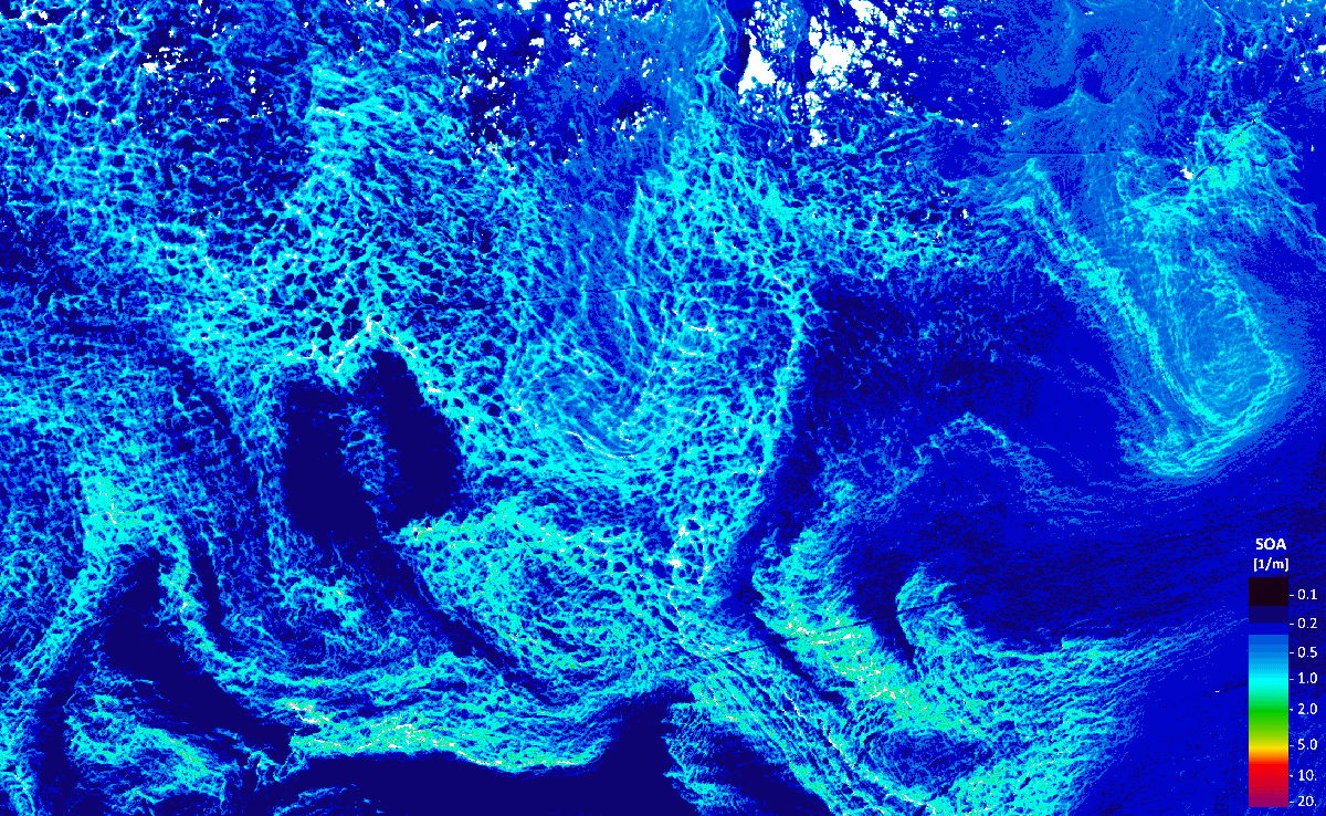
The image covers about 65*40 km of the most structured part of the bloom. The image above shows EOMAP’s Sum of Organic Absorption (SOA) product which is the absorption of light [1/m] by particulate and dissolved organic matter. The highest values of organic absorption (light blue) can therefore be found along the densest algal patches.
Other EOMAP products reveal further characteristics of the most recent bloom:
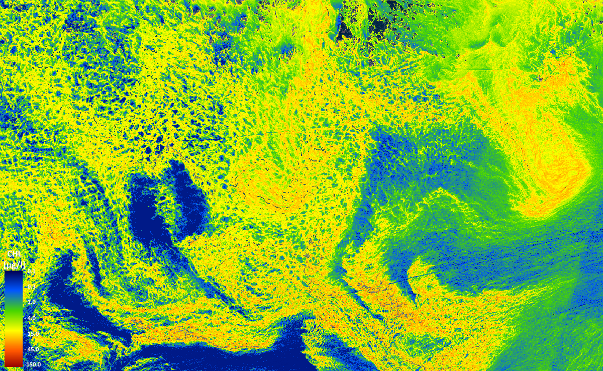
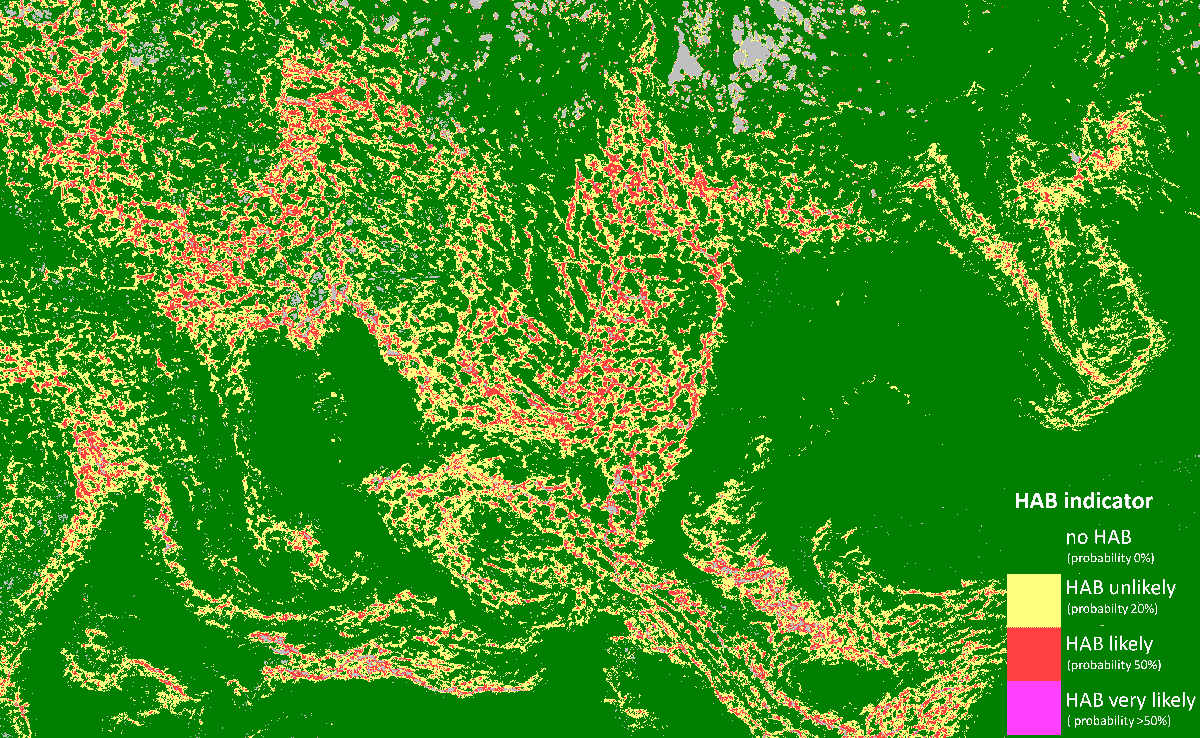 On the top image, EOMAP’s chlorophyll-a product, provides an absolute measure of the chlorophyll-a concentration in [µg/l]. Moreover, the company’s recently launched harmful algae bloom (HAB) indicator algorithm (for further reading please read here) indicates the presence of cyanobacteria containing phycocyanin. Indeed, the algal bloom contains cyanobacteria of type Nodularia1 which are a common for algal blooms in the Baltic Sea2.
References:
1NASA Earth Observatory
2HELCOM
Further Reading:
EOMAP HAB indicator press release
EOMAP Featured Image

Latest EOMAP News

Reuters bases Mekong article on EOMAP data
The Development of EOMAP’s Water Quality Platform

UNESCO Water Quality Portal launched

Launching the world’s first comprehensive global water quality atlas with UNESCO

Oman Oil Spill: SDB Mapping of Critical Shallow Waters for Safe Salvage

eoapp DIVE unterstützt die Tauchplanung
Related Posts
09 / 2026
The Development of EOMAP’s Water Quality Platform
09 / 2026
UNESCO Water Quality Portal launched

08 / 2026
Launching the world’s first comprehensive global water quality atlas with UNESCO

08 / 2026
eoapp DIVE unterstützt die Tauchplanung
06 / 2026
Dredge plume monitoring using satellite-based turbidity mapping
04 / 2026
Advocating for Healthy Mountain Ecosystems
04 / 2026
Environmental monitoring for sporting events

04 / 2026
20 Years EOMAP: Advancing Earth Observation

03 / 2026
New BD & Sales Manager for the Americas
03 / 2026

