Hamburg, September 2018 Following the success of last year’s workshop, MarSat, a corporate network of four private companies and a research institute, hosted its second workshop on the potential value of satellite data services for companies in the maritime and marine industry. The workshop took place in Hamburg as part of the SMM, the world’s biggest Maritime Trade Fair, earlier this month.
MarSat, funded by the BMWi, the German Federal Ministry for Economic Affairs and Energy, develops new innovative services for the maritime industry using satellite data.
The workshop drew more than 30 potential users from shipping companies, commercial operators, system service providers and consulting services. The aim of the workshop was to cross-fertilize ideas on how maritime companies benefit from satellite data services and how they can integrate them in their daily routine.
With presentations on the Ice-Pad, a portable Ice-Pilot Unit and Satellite-Derived Bathymetry based chart production, the participants discussed the current status of navigation, voyage planning, data integration and in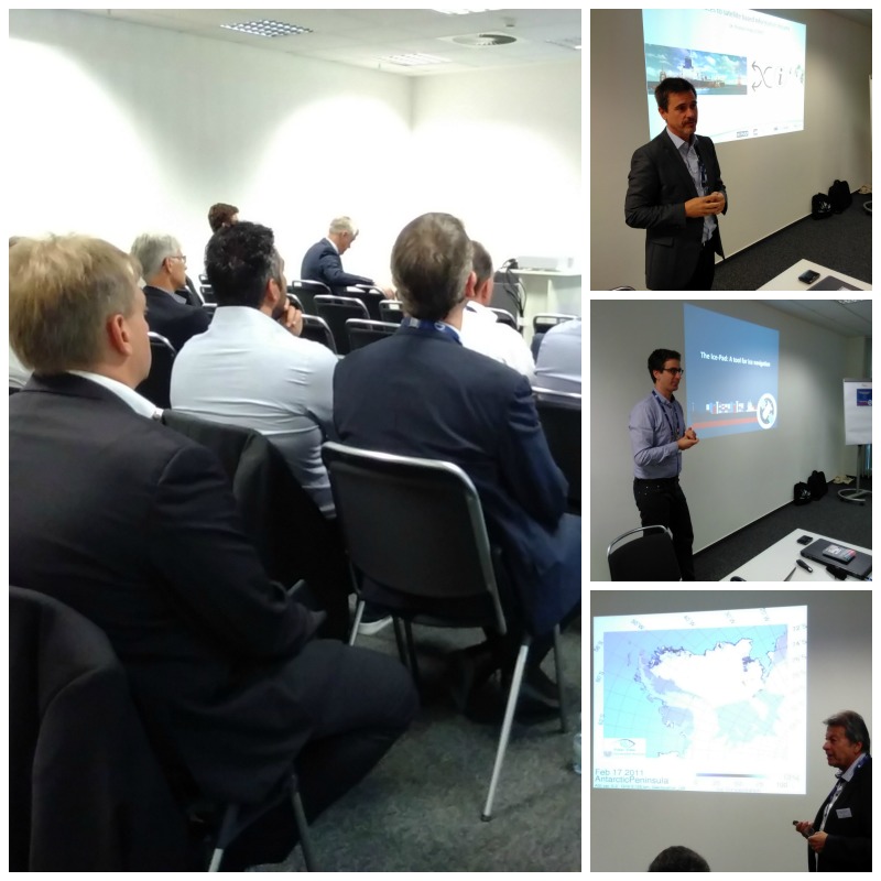 terfaces to satellite based information streams.
Captain Uwe Pahl, team leader of the construction supervision team of Reederei F. Laeisz for the new Polarstern II, shared his extensive experience with the audience on how challenging it is to navigate such a large vessel through the polar seas.
Valuable MarSat Solutions
MarSat solutions are already being tested by industry. As part of the Norwegian Seabed Mapping Programme, Fugro is assessing MarSat’s Ice-Pad solution, an innovative ice information service, to collect the most recent information on ice coverage and supports the project with their voyage planning and tactical navigation solutions.
The audience also discussed the opportunities of Satellite-Derived Bathymetry when implementing it in operational chart production processes. “Satellite-derived Bathymetry (SDB) helps to improve depth information in charts and it can contribute to efficient voyage optimization.”
“The next steps towards operational use include the identification and systematic definition of SDB suitable areas and of areas where the quality of depth information in existing ENCs is poor or not assessed.” Friedhelm Moggert-Kägeler, Head of Product Management, SevenCs.
“What we have learnt again from this year’s workshop and the results of our two-and-a-half-year project is that the use of satellite data and Earth Observation products in the maritime world has an enormous potential. We are at the very beginning, just starting to get a glimpse at the possibilities and huge benefits these innovative technologies will offer.” Dr. Nils Meyer-Larsen, Project Manager, Institute of Shipping, Economics and Logistics (ISL).
More about MarSat
MarSat is a network of small and medium-sized enterprises and a research institute and combines extensive expert knowledge in the field of satellite services, software development, and maritime services. MarSat is being financed and coordinated by the DLR German Space Administration with funding from the German Federal Ministry for Economic Affairs and Energy (BMWi).