Introduction
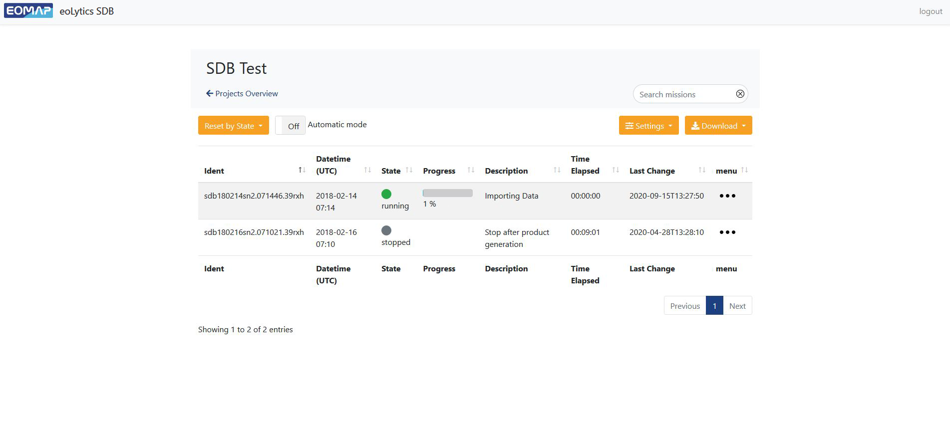
EOMAP’s eoLytics SDB is a truly unique web application that allows you to generate Satellite-Derived Bathymetry information to fill data gaps and expand your survey coverage.
Its technology is based on physics based image analysis and latest AI methods. This combination enables you to expand your shallow water survey data by several times or fill data gaps of your acoustic single beam survey data – within an average processing time of only one hour.
eoLytics SDB is a completely transparent software. All analyses and results are automatically saved and documented and results are repeatable. Software licensing comes with expert support in SDB methods and IT.
eoLytics SDB is also available as a desktop software called LiteCor-X.

Advantages at a glance
- Use any browser on any device. No dependencies on hard- or software.
- Robust and very easy to use, even for non-experts.
- Access multiple satellite archives without the need to download terrabytes of satellite data or care about time-consuming analyses.
- Generate validated shallow water bathymetric data to fill survey gaps or expand survey coverage.
- Rapid access to bathymetric results, typically in less than one hour.
Request a Demo
Interested? Please contact us to purchase a license or request an online demo.
Error: Contact form not found.
FAQ
What makes EOMAP’s service unique? Why does EOMAP’s data service stand out?
EOMAP’s satellite-derived bathymetry services have been widely used and validated in practice. Our clients acknowledge and benefit from the quality of our bathymetric data, our extensive background knowledge and high level of service readiness. EOMAP’s SDB methods have been developed over the last two decades and are being constantly maintained and improved. No other method and service has this kind of continuous and systematic scientific validation.
What is the maximum mapping depth and how can I query it for my location?
The maximum water depth mapped by SDB is similar to the maximum penetration depth of sunlight. Since this varies by season and location, a global depth statement is not appropriate. The following mapping depths have been analysed: Red Sea (20–30 m), Gulf region (5–15 m from north to south), Mediterranean Sea (20–30 m), Baltic Sea (2–15 m from north to south), Caribbean Sea (20–30 m), US West Coast (5–15 m), Pacific region (20–30 m).
EOMAP’s EO Store Bathymetry offers a unique map layer to estimate the Satellite-Derived Bathymetry feasibility and helps to explore the coverage for almost any marine location on earth.
What are the vertical/depth uncertainties?
Depth uncertainties are provided with each data delivery and are expressed as LE90 confidence limits, meaning that 90% of the data fall within the stated depth uncertainty. These uncertainties are a combination of internal model uncertainties (such as the sensitivity of the sensor) and external uncertainties (uncertainties regarding tides) and are compared against on-site or charting data, if accessible. With ideal scenarios and on-site information, EOMAP’s SDB data are accurate to 0.5 m LE90. Without access to on-site information, the uncertainty is typically between 0.5 m and 1.0 m LE90 and a depth dependent factor between 10 and 15% of water depth.
What are the horizontal/geolocation uncertainties?
The geolocation uncertainties are determined by the spatial resolution of the bathymetric data grid and thus by the satellite source. They are expressed as CE90 confidence limits, meaning that 90% of the data fall within the stated horizontal uncertainty. For 2 m bathymetric grids, the horizontal uncertainty is 5 m CE90, for 10 m grids it is 10 m CE90 or better and for 30 m grids it is 30 m CE90.
Can I open the data in GIS?
Yes. All our deliverables conform to OGC standards and can easily be opened, visualised and analysed in any GIS.
Can I open the data in hydrographic software?
Yes. All our deliverables conform to OGC standards and can easily be opened, visualised and analysed in any hydrographic software.
Can I insert the data into my models?
Yes. All our deliverables conform to OGC standards and come with metadata conforming to ISO 19139. They can easily be opened, visualised and analysed using scripts or models.