Belizean shallow waters from Space – The largest survey of its kind in the Caribbean –
EOMAP delivers Satellite-Derived Bathymetry to UKHO
(Seefeld, Germany, World Hydrography Day 2022) – In early 2022, EOMAP started mapping the shallow waters of Belize using SDB technology. Parts of these approximately 9,000 square kilometres had never been sufficiently surveyed before. Now, the bathymetry grids – the first lot of a multi-year framework contract – have been delivered to UK Hydrographic Office (UKHO).
„Satellite Derived Bathymetry plays an incredibly important role in improving our understanding of shallow coastal or remote areas not easily accessible by traditional methods. The data collected on behalf of Belize by the Commonwealth Marine Economies Programme will help management and sustainable development of the waters of Belize and strengthen future activities to support safety of the mariner and the environment“, says Ian Davies, International Hydrographic Portfolio Manager, UKHO.
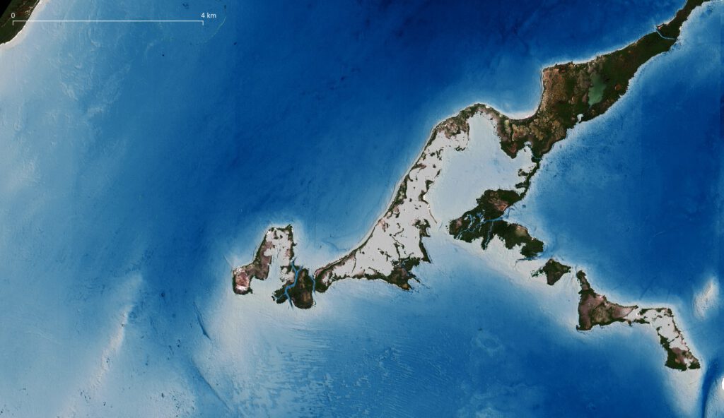
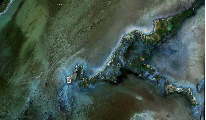
A small subset of the Belizian SDB survey for UKHO, depth shown in white to blue colors. (c) EOMAP – incl. copyrighted materials of (c) Maxar, 2022
The survey covers all shallow coastal and marine waters of Belize down to a water depth of 20 metres on offshore reefs. Multi-image SDB concepts were applied to overcome local challenges of variable turbidity and cloud gaps. EOMAP has refined 35 very-high resolution records from Maxar’s multispectral satellites, ESA’s Sentinel-2 with 180 tiles as well as Planet’s SuperDove data for selected areas.
In addition, EOMAP used millions of space-born active laser measurements to create a Satellite-Lidar Bathymetry (SLB) database. This resulted in about 1 million single depth measurements from the active Lidar system ICESat-2 ATLAS instrument, thus providing further verification and proof of the created bathymetric grids. Finally, the German team has created and provided reflectance datasets of the shallow water environment – crucial for characterisation and classification of shallow water habitats. They have been shared with the Belizean authorities.
„In order to keep bathymetric information up to date easily, we’ve now developed SDB-Online: This WebApp automates the above complex processes and thus allows users to create bathymetry grids within 15 to 120 minutes. It builds on archived or most recent satellite records”, says Mona Reithmeier – SDB expert and SDB-Online Manager at EOMAP. The new WebApp can be used to constantly update the bathymetric data in Belize and is helpful for any shallow water stakeholder.
By this extensive survey in Belize – just like by contributions to Seabed2030 and EMODnet Bathymetry – EOMAP continues to strengthen bathymetry knowledge, hydrography and coastal resilience in the Caribbean and worldwide.
End 2021, EOMAP was – again – ranked first-choice provider of SDB by UKHO. Apart from high-class hydrographers and surveyors it is coastal zone managers and engineers all over the world who value the German tech leader’s satellite-based information on shallow waters.
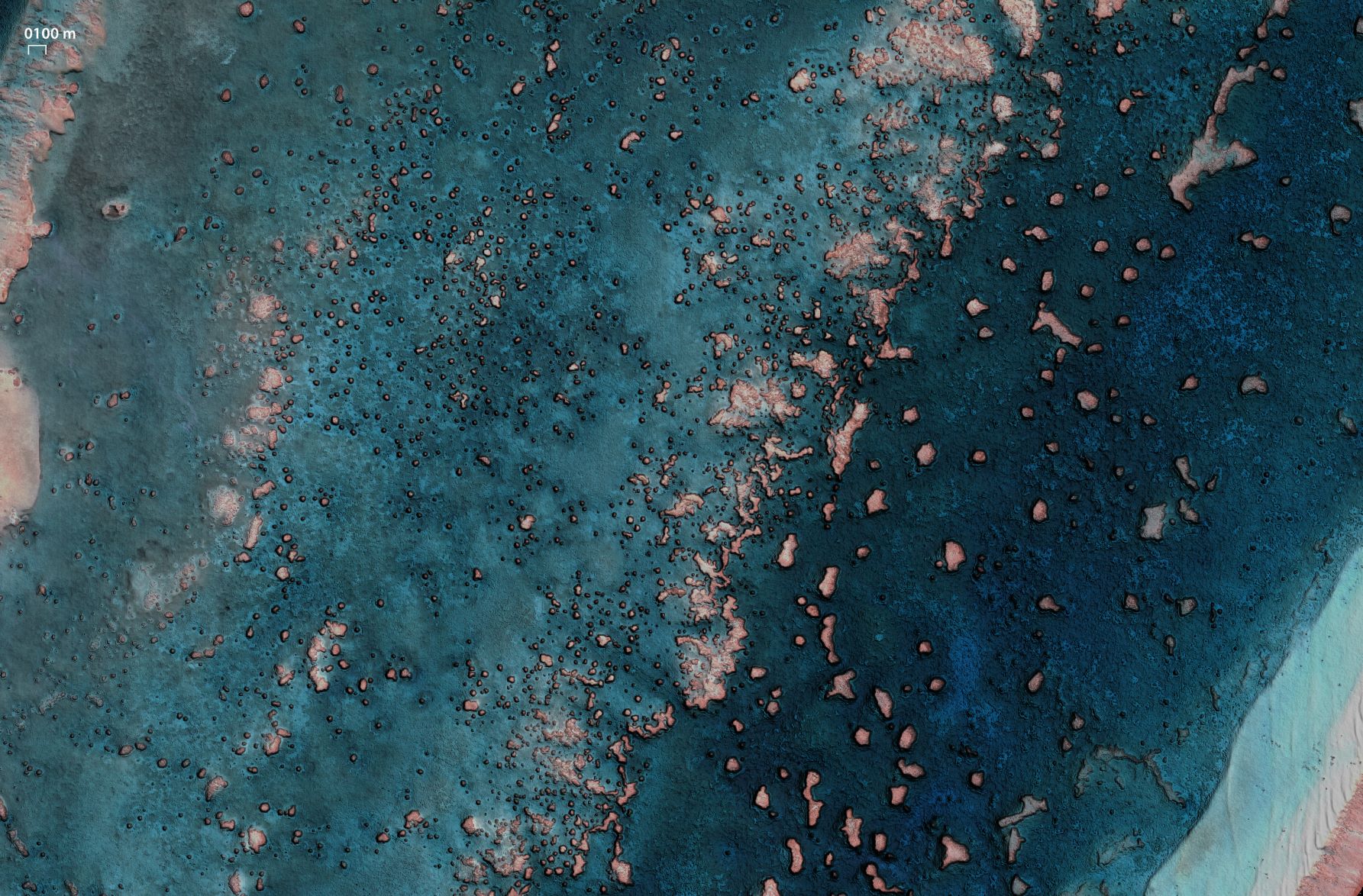
Real-color image of seabed reflectance derived from EOMAP’s SDB technology. It enhances seafloor charactersiation and allows for mapping seabed habitats and features. (c) EOMAP – contains material of (c) Maxar, 2022
Notes to the Editor:
Satellite-Derived Bathymetry (SDB)
SDB is a rising technique using satellite data records and analytical methods for producing “digital twins” of shallow waters. EOMAP’s SDB concept is to quantify water depth by inverting the radiative transfer model. This model describes the modulation of sunlight as it passes through the atmosphere, water surface, water column and is reflected back to the satellite sensor from the seafloor. In short, water depth is derived from light energy in different wavelengths which are recorded by satellites. Compared with ship and airborne survey methods, SDB allows mapping extensive aquatic zones remotely and within a fraction of time. SDB data by EOMAP have been integrated into nautical charts, are part of the European harmonized bathymetric grid, serve the management of the Great Barrier Reef and many other coastal stakeholders. Advances in accuracy and awareness of this effective surveying method keep driving the demand.
About the UK Hydrographic Office (UKHO)
The UK Hydrographic Office is a leading centre for hydrography, providing marine geospatial data to inform maritime decisions. They work with a wide range of data suppliers and partners to support maritime navigation, safety, security and marine development around the UK and worldwide.
The UKHO make location-based information available through ADMIRALTY Maritime Data Solutions, their world-leading range of charts, publications and custom data sets. They source, process and provide access to location-based information, ranging from seabed to surface. This enables partner organisations to make critical maritime decisions – informing the sustainable use and management of the marine environment and supporting the development of the blue economy.
About EOMAP
EOMAP provides high quality satellite-derived data products and software services for a panoptic view on coastal and inland waters. Via a better understanding of this crucial environment, the international team wishes to contribute to a sustainable management. Founded in 2006, EOMAP has its headquarters near Munich, Germany and maintains offices in Australia, USA, Indonesia and in the United Arab Emirates.
Latest EOMAP News

Reuters bases Mekong article on EOMAP data

Dredge plume monitoring using satellite-based turbidity mapping

Pioneering seagrass mapping at the Italian coastline in 2006

Mapping Ningaloo Reef 2009: A Breakthrough in Hyperspectral Marine Habitat Analysis

Advocating for Healthy Mountain Ecosystems

Environmental monitoring for sporting events
Related Posts

05 / 2026
Pioneering seagrass mapping at the Italian coastline in 2006

04 / 2026
Mapping Ningaloo Reef 2009: A Breakthrough in Hyperspectral Marine Habitat Analysis

04 / 2026
20 Years EOMAP: Advancing Earth Observation

03 / 2026
New BD & Sales Manager for the Americas

02 / 2026
WATCOR‑X Bathymetry Software for Navies and Hydrographic Offices

01 / 2026
Bathymetry in the Gulf of Mexico

12 / 2025
A short recap of 2025

11 / 2025
Projektstart SEAGUARD

10 / 2025
SDB Update #9 – Validation and Accuracy

10 / 2025
